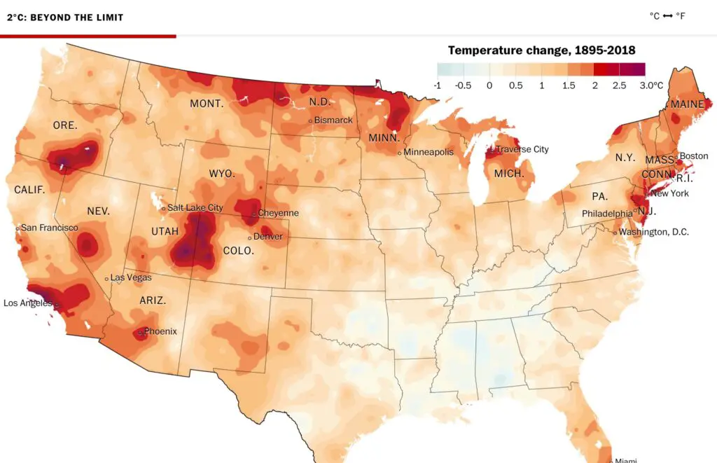
A groundbreaking analysis of National Oceanic and Atmospheric Administration temperature data by the Washington Post shows major areas of the United States near or have already crossed the 2-degree Celsius mark. Michigan Climate Change is here in our state too. The two-degree Celsius measurement is thought to indicate a doubling of CO2 levels from preindustrial levels. This could be a tipping point for catastrophic environmental change. Data was taken from more than a century across the Lower 48 states and 3,107 counties to create this hot spot map.

Michigan’s Climate Change is Measurable

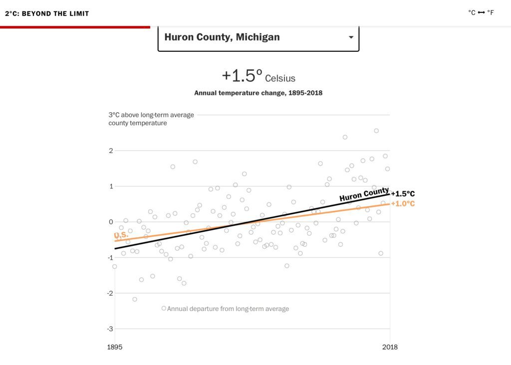
The Grand Traverse County area in northwest Michigan has exceeded 2.3C in measurements taken since 1885. Closer to home, Huron County’s average rise is 1.5C.
The impact of this slowing rising temperature affects our environment in different ways. Warmer winters mean less ice and snow coverage. When Lake Huron freezes over the ice and snow reflect solar radiation back into space, keeping the area relatively cool. But with less ice and snow, the lake and ground absorb the solar radiation and warm into a self-feeding cycle.
Other Impacts of Climate Change in Michigan

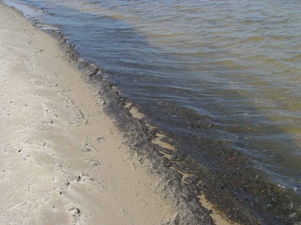
The other effects to agricultural growing seasons and lake water quality are a concern too. Pests, no longer controlled by cold winter weather, are affecting people and crops with increasing frequency. Toxic blue-green algae are a regular feature in Lake Erie and Saginaw Bay in late summer. It’s advisable to avoid swimming, wading, and watersport activities when pea-soup-like algae are seen on the beach.
Source Michigan Climate Change
2°C: BEYOND THE LIMIT – Extreme climate change has arrived in America – Washington Post
Climate Change Resources
Related Reading climate change predictions for michigan
Saginaw Bay Muck is Poop. – Huron County lakefront owners have known for years that the declining water quality in Saginaw Bay is due to two factors. 1) Outdated and failing septic tanks and overflow from Saginaw and Bay City from the Saginaw River. 2) Concentrated Animal Feeding Operations CAFOs.
Michigan’s Saginaw Bay Region has been on the EPA list for 30 Years – Back in the era of Big Hair, Members Only jackets, and Yuppies, the EPA and the State of Michigan designated the entire region as a potential environmental disaster. The deterioration and pollution were so bad that the label of “Area of Concern” was slapped on the Saginaw Bay in 1987 and has not been lifted for 30 years.
Water Levels Near-Record Levels in Michigan-Huron – In 2019, the Detroit Army Corps of Engineers is reporting that all of the Great Lakes have exceeded record water levels last seen in the 1980s, except for the Lake Huron-Michigan Water Levels.
Michigan Thumb Webcams – These live Michigan Thumb webcams are strategically located in various spots along the St.Clair River, Lake Huron shore, and Saginaw Bay within the Thumb region. It is a great place to check out the weather view passing ships and freighters and note lake conditions from the comfort of your home or office.


